Peninsula and the blue zones
by Henryk Szubinski
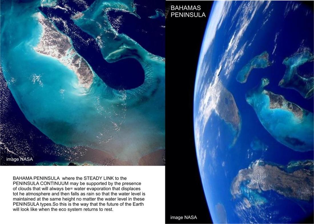
The beautiful vision that no matter how our Earth changes by flooding or other Earth crust motions, the peninsula will always remain as the
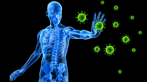
basic feature that connects one land to the other and the oceans.The reason being immunity, that just as humans have an immunity response, the
Earth does also.The ocean immunity =Peninsula.
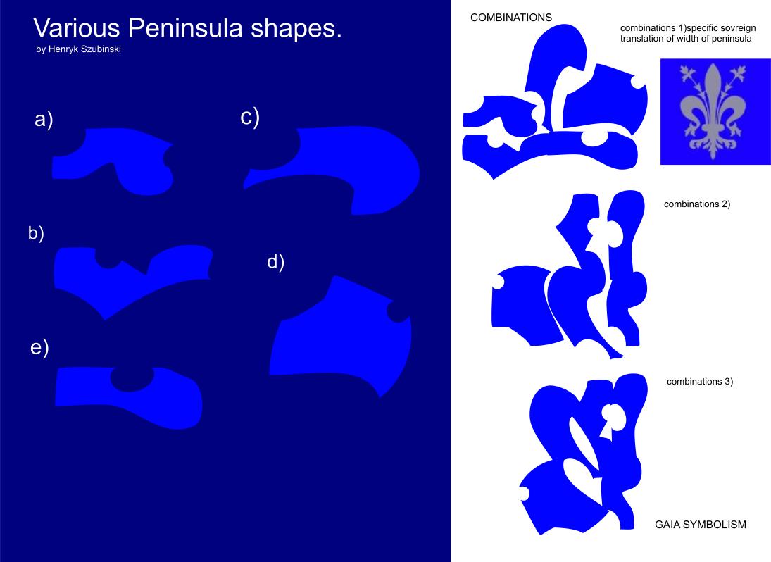
Peninsula are "ALMOST ISLAND " meaning they are not islands but are part of their mainland which may have smaller width than the mainland.
type reverse width=ratio that remains the same in relation to land and water.
from Wkipedia
date, 07,03,2017
time, 18:04
A peninsula (Latin: paeninsula from paene "almost" and insula "island") is a piece of land surrounded by water on the majority of its border, while being connected to a mainland from which it extends out. Examples include the upper and lower peninsulas of the state of Michigan, the peninsula plateau of downtown Vancouver, or the Niagara peninsula.[1][2][3][4] The surrounding water is usually understood to be continuous, though not necessarily named as a single body of water. Peninsulas are not always named as such; one can also be a headland, cape, island promontory, bill, point, or spit.[5] A point is generally considered a tapering piece of land projecting into a body of water that is less prominent than a cape.[6] A river which courses through a very tight meander is also sometimes said to form a "peninsula" within the (almost closed) loop of water. In English, the plural of peninsula is peninsulas or, less commonly, peninsulae.
Peninsula and the blue zones
by Henryk Szubinski
The beautiful vision that no matter how our Earth changes by flooding or other Earth crust motions, the peninsula will always remain as the
basic feature that connects one land to the other and the oceans.The reason being immunity, that just as humans have an immunity response, the
Earth does also.The ocean immunity =Peninsula.
Peninsula are "ALMOST ISLAND " meaning they are not islands but are part of their mainland which may have smaller width than the mainland.
type reverse width=ratio that remains the same in relation to land and water.
from Wkipedia
date, 07,03,2017
time, 18:04
A peninsula (Latin: paeninsula from paene "almost" and insula "island") is a piece of land surrounded by water on the majority of its border, while being connected to a mainland from which it extends out. Examples include the upper and lower peninsulas of the state of Michigan, the peninsula plateau of downtown Vancouver, or the Niagara peninsula.[1][2][3][4] The surrounding water is usually understood to be continuous, though not necessarily named as a single body of water. Peninsulas are not always named as such; one can also be a headland, cape, island promontory, bill, point, or spit.[5] A point is generally considered a tapering piece of land projecting into a body of water that is less prominent than a cape.[6] A river which courses through a very tight meander is also sometimes said to form a "peninsula" within the (almost closed) loop of water. In English, the plural of peninsula is peninsulas or, less commonly, peninsulae.
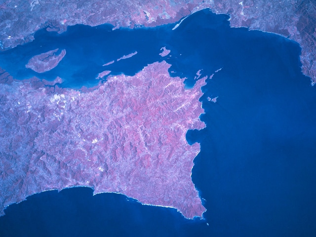
Here are the 3 Peninsula
1)
The Baja California Peninsula (English: Lower California Peninsula, Spanish: Península de Baja California) is a peninsula in Northwestern Mexico. Its land mass separates the Pacific Ocean from the Gulf of California. The peninsula extends 1,247 km (775 miles) from Mexicali, Baja California in the north to Cabo San Lucas, Baja California Sur in the south. It ranges from 40 km (25 miles) at its narrowest to 320 km (200 miles) at its widest point and has approximately 3,000 km (1,900 miles) of coastline and approximately 65 islands. The total area of the Baja California Peninsula is 143,390 km2 (55,360 sq mi).
The peninsula is separated from mainland Mexico by the Gulf of California and the Colorado River. There are four main desert areas on the peninsula: the San Felipe Desert, the Central Coast Desert, the Vizcaíno Desert and the Magdalena Plain Desert.
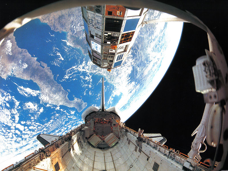
Here's Baia from space shuttle.
image courtesy NASA
1)
The Baja California Peninsula (English: Lower California Peninsula, Spanish: Península de Baja California) is a peninsula in Northwestern Mexico. Its land mass separates the Pacific Ocean from the Gulf of California. The peninsula extends 1,247 km (775 miles) from Mexicali, Baja California in the north to Cabo San Lucas, Baja California Sur in the south. It ranges from 40 km (25 miles) at its narrowest to 320 km (200 miles) at its widest point and has approximately 3,000 km (1,900 miles) of coastline and approximately 65 islands. The total area of the Baja California Peninsula is 143,390 km2 (55,360 sq mi).
The peninsula is separated from mainland Mexico by the Gulf of California and the Colorado River. There are four main desert areas on the peninsula: the San Felipe Desert, the Central Coast Desert, the Vizcaíno Desert and the Magdalena Plain Desert.
Here's Baia from space shuttle.
image courtesy NASA
2)
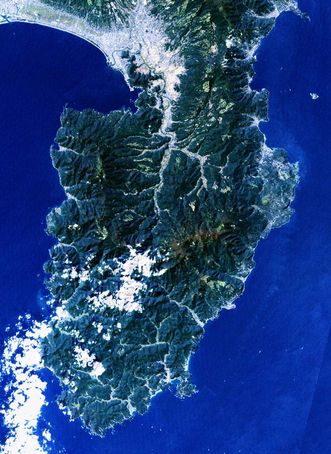
The Izu peninsula (伊豆半島 Izu-hantō?) is a large mountainous peninsula with deeply indented coasts to the west of Tokyo on the Pacific coast of the island of Honshū, Japan. Formerly the eponymous Izu Province, Izu peninsula is now a part of Shizuoka Prefecture. The peninsula has an area of 1,421.24 km² and its estimated population in 2005 was 473,942 people.
image courtsy NASA
3)
The Nicoya Peninsula (Spanish: Península de Nicoya) is a peninsula on the Pacific coast of Costa Rica. It is divided into two provinces: Guanacaste Province in the north, and the Puntarenas Province in the south. It is located at 10°N 85.4166667°W. It varies from 19 to 37 miles (60 km) wide and is approximately 75 miles (121 km) long, forming the largest peninsula in the country. It is known for its beaches and is a popular tourist destination.
The main transport and commercial centre in the region is Nicoya, one of the oldest settlements in Costa Rica. Ferries run between the town of Puntarenas on the mainland and the Nicoya Peninsula. There is an international airport in Liberia and small domestic airstrips in Nosara, Carrillo and Tambor.[1] The region was also featured in the book Blue Zones, by Dan Buettner, which focused on the longevity found among Nicoya's residents.[2]
image courtesy NASA
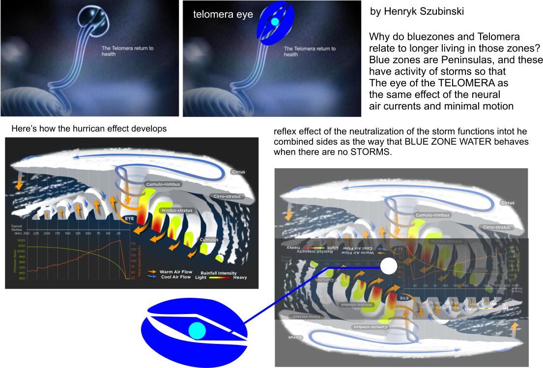
every type of Peninsula has it's flooding and storm activity.
So this has to be taken into consideration when defining the blue zone specific function and the telomera (immortal cells of the human immunity ).
from NASA
on how cyclones become the blue zones:
Tropical cyclones are like giant engines that use warm, moist air as fuel. That is why they form only over warm ocean waters near the equator. The warm, moist air over the ocean rises upward from near the surface. Because this air moves up and away from the surface, there is less air left near the surface. Another way to say the same thing is that the warm air rises, causing an area of lower air pressure below.
Cumulonimbus cloud
A cumulonimbus cloud. A tropical cyclone has so many of these, they form huge, circular bands.
Air from surrounding areas with higher air pressure pushes in to the low pressure area. Then that "new" air becomes warm and moist and rises, too. As the warm air continues to rise, the surrounding air swirls in to take its place. As the warmed, moist air rises and cools off, the water in the air forms clouds. The whole system of clouds and wind spins and grows, fed by the ocean's heat and water evaporating from the surface.
Storms that form north of the equator spin counterclockwise. Storms south of the equator spin clockwise. This difference is because of Earth's rotation on its axis.
As the storm system rotates faster and faster, an eye forms in the center. It is very calm and clear in the eye, with very low air pressure. Higher pressure air from above flows down into the eye.
The human body's immunity response as the telomera may also function when the human body goes through STORMY activity and the need for centration by knowing the
opposite of the problem= knowing which immunity the human body needs to survive.
The human body cannot totally experience the inner storm activity of the human immunity responses when there are various problems in the body. However the body may make some basic responses to it's environment by some basic visualizations of "being in the eye of the storm "
As though pushing away the storm eye from various positions.
As though pushing away the storm eye from various positions.