Continental blue zones that are on Earth and "used to be", billions of years ago.
by Henryk Szubinski
from Wikipedia
date,13,08,2016
time, 11:23
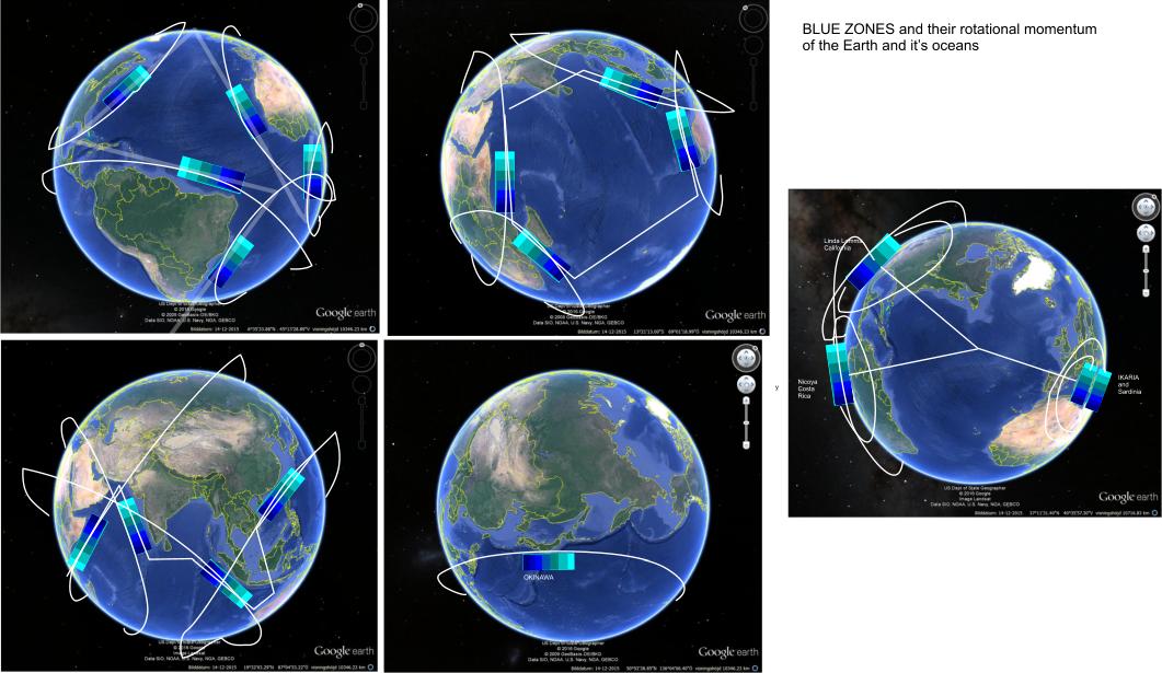
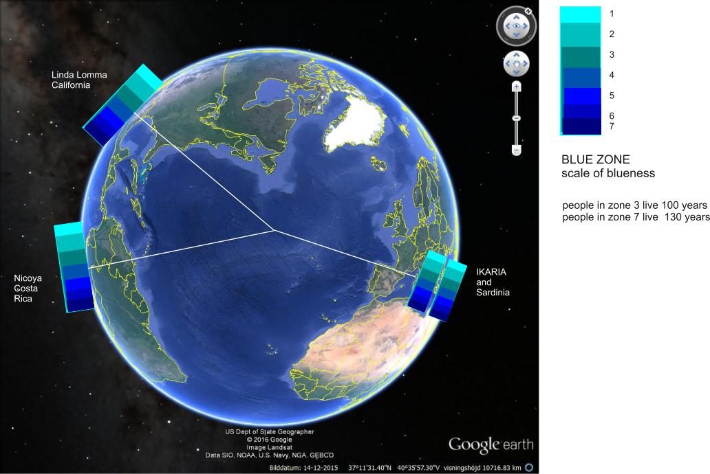
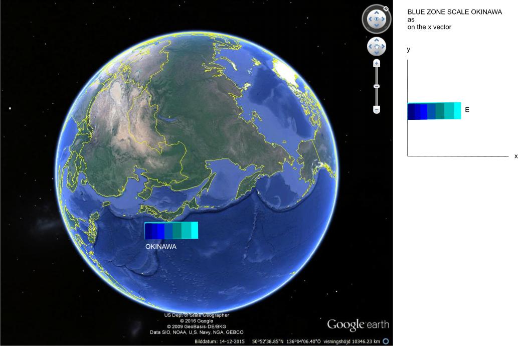
Blue Zones is a concept used to identify a demographic and/or geographic area of the world where people live measurably longer lives. The concept grew out of demographic work done by Gianni Pes and Michel Poulain,[1] who identified Sardinia's Nuoro province as the region with the highest concentration of male centenarians. As the two men zeroed in on the cluster of villages with the highest longevity, they drew concentric blue circles on the map and began referring to the area inside the circle as the Blue Zone. Dan Buettner identifies longevity hotspots in Okinawa (Japan); Sardinia (Italy); Nicoya (Costa Rica); Icaria (Greece); and among the Seventh-day Adventists in Loma Linda, California, and offers an explanation, based on empirical data and first hand observations, as to why these populations live healthier and longer lives.
Here then, my theory.

from Wikipedia
date ,13,08,2016
time, 11:42
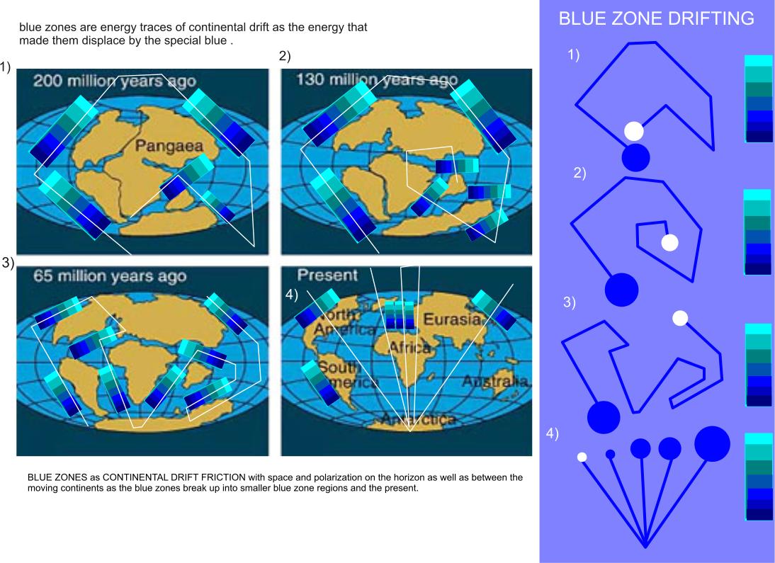
Continental drift is the movement of the Earth's continents relative to each other, thus appearing to "drift" across the ocean bed.[2] The speculation that continents might have 'drifted' was first put forward by Abraham Ortelius in 1596. The concept was independently and more fully developed by Alfred Wegener in 1912, but his theory was rejected by some for lack of a mechanism (though this was supplied later by Arthur Holmes) and others because of prior theoretical commitments. The idea of continental drift has been subsumed by the theory of plate tectonics, which explains how the continents move.[3]
In 1858 Antonio Snider-Pellegrini created two maps demonstrating how the American and African continents might have once fit together.
date ,13,08,2016
time, 11:42
Continental drift is the movement of the Earth's continents relative to each other, thus appearing to "drift" across the ocean bed.[2] The speculation that continents might have 'drifted' was first put forward by Abraham Ortelius in 1596. The concept was independently and more fully developed by Alfred Wegener in 1912, but his theory was rejected by some for lack of a mechanism (though this was supplied later by Arthur Holmes) and others because of prior theoretical commitments. The idea of continental drift has been subsumed by the theory of plate tectonics, which explains how the continents move.[3]
In 1858 Antonio Snider-Pellegrini created two maps demonstrating how the American and African continents might have once fit together.