BLUE ZONES and WATER FALLS.
SCIFI SCIENCE theory of SCIFI SCIENCE ARCHAEOLOGY.
AIM:
SEARCHING FOR FRAGMENTS of SOME LARGER STORY of our PAST.
by Henryk Szubinski
Blue zones are special areas where people live to be on the average about 100 or more.
The theory will show how the Waterfalls of the Earth may be related to their massive flow
of water as having links with the blue zones by comparing positions and the similarity to the
TELOMERA "immortal cells of the human body".

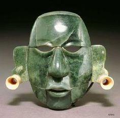
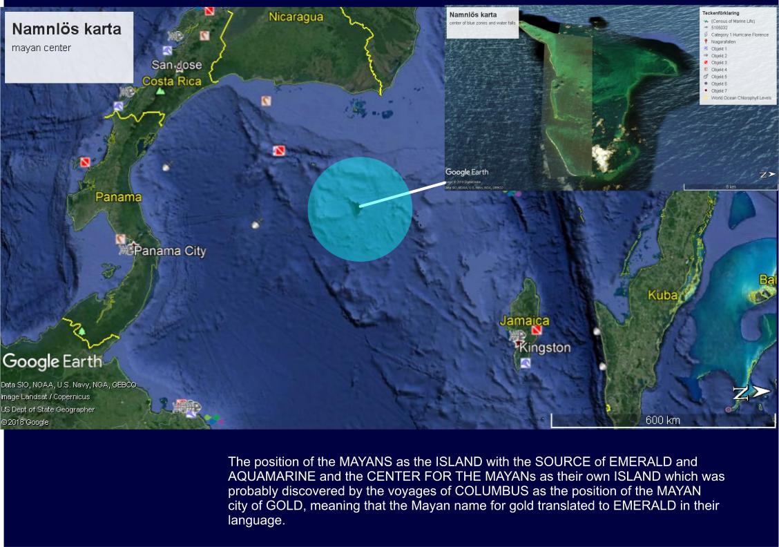
Is JADE or EMERALD and the TRACE to AQUAMARINE = the ORIGIN of the MAYAN MYTHS of CREATION and the SOURCE of the BLUE ZONES?.and the place of ELDORADO.
We start the search with the greatest water falls on the planet Earth and then compare the BLUE ZONES.
Because waterfalls are powerful places of water flow, and the blue zones are powerful places of health and
longevity, there has to be some LINK BETWEEN THEM.
It is this motivation that i set out to define the places of the waterfalls and find some LINKS to the BLUE ZONES.
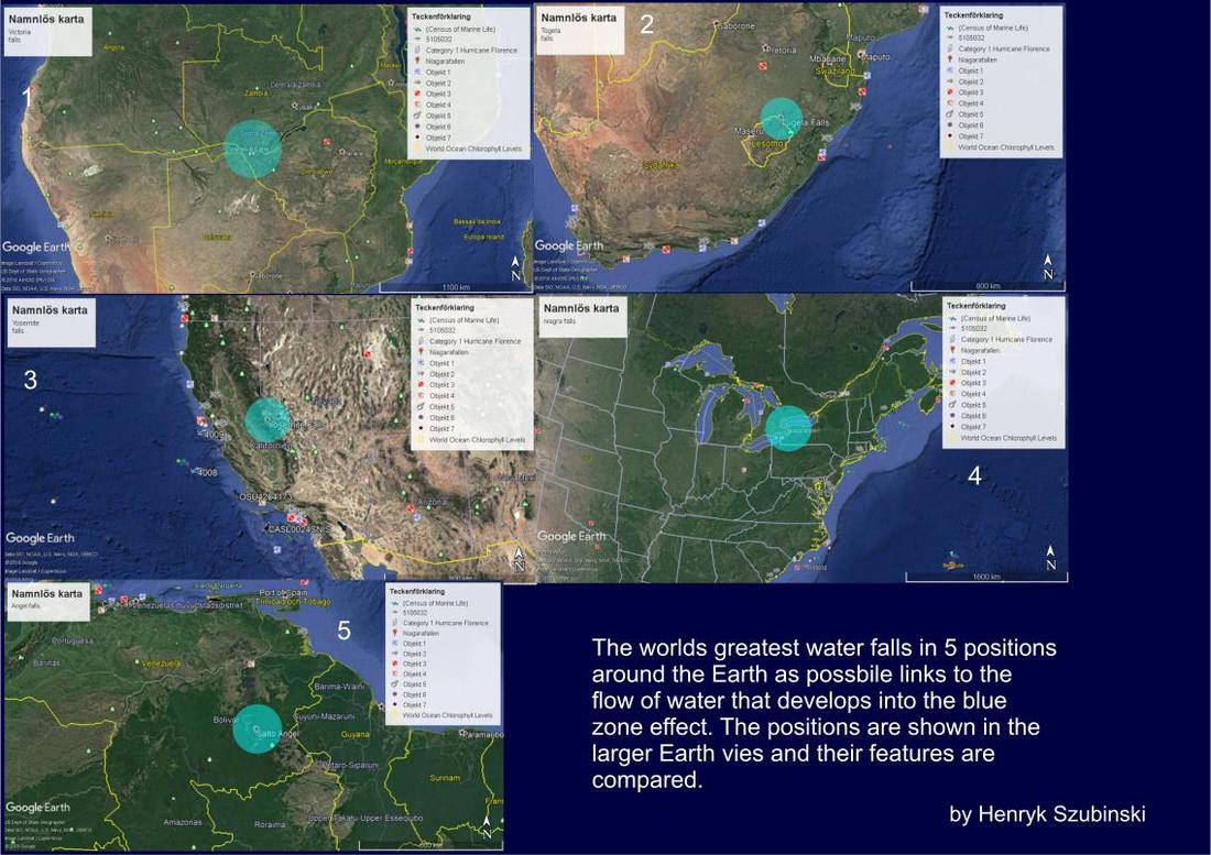
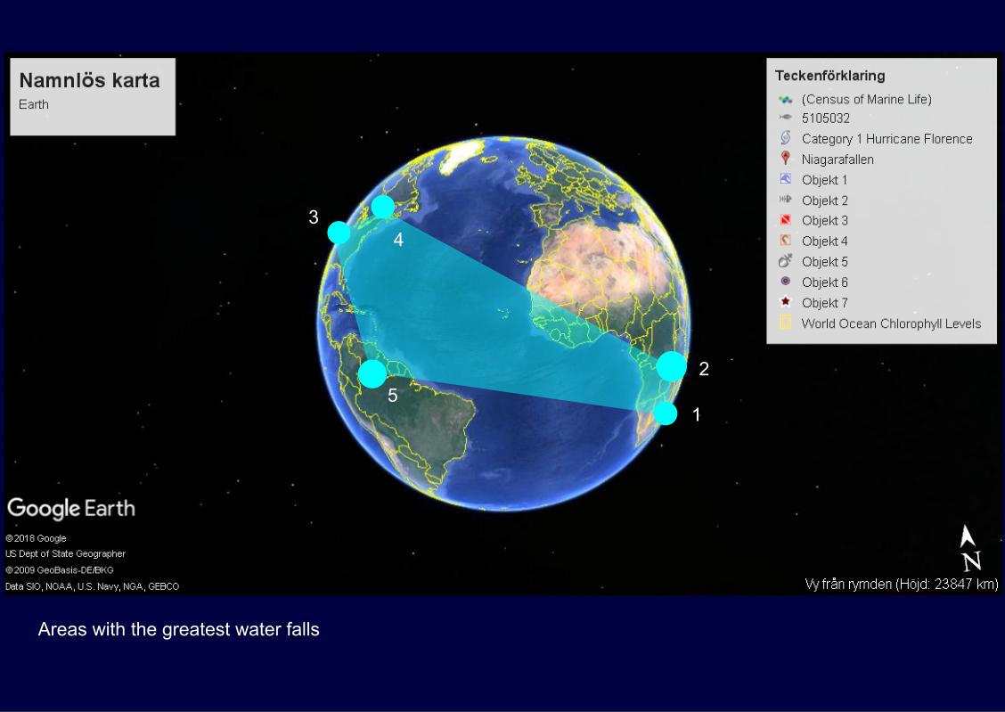
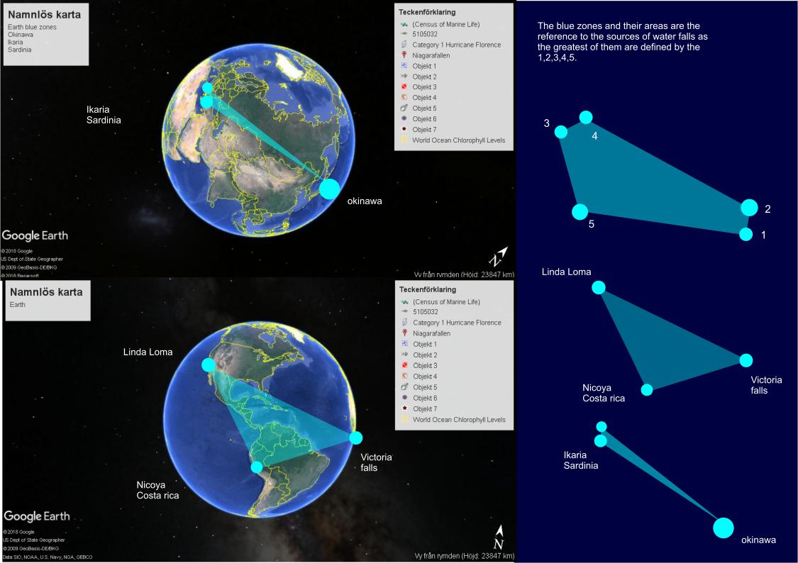
The Earth positions are on either sides of it as the Linda Loma, Victoria falls and NICOYA are on one side and the
IKARIA, SARDINIA with OKINAWA is on the other side.
IKARIA, SARDINIA with OKINAWA is on the other side.
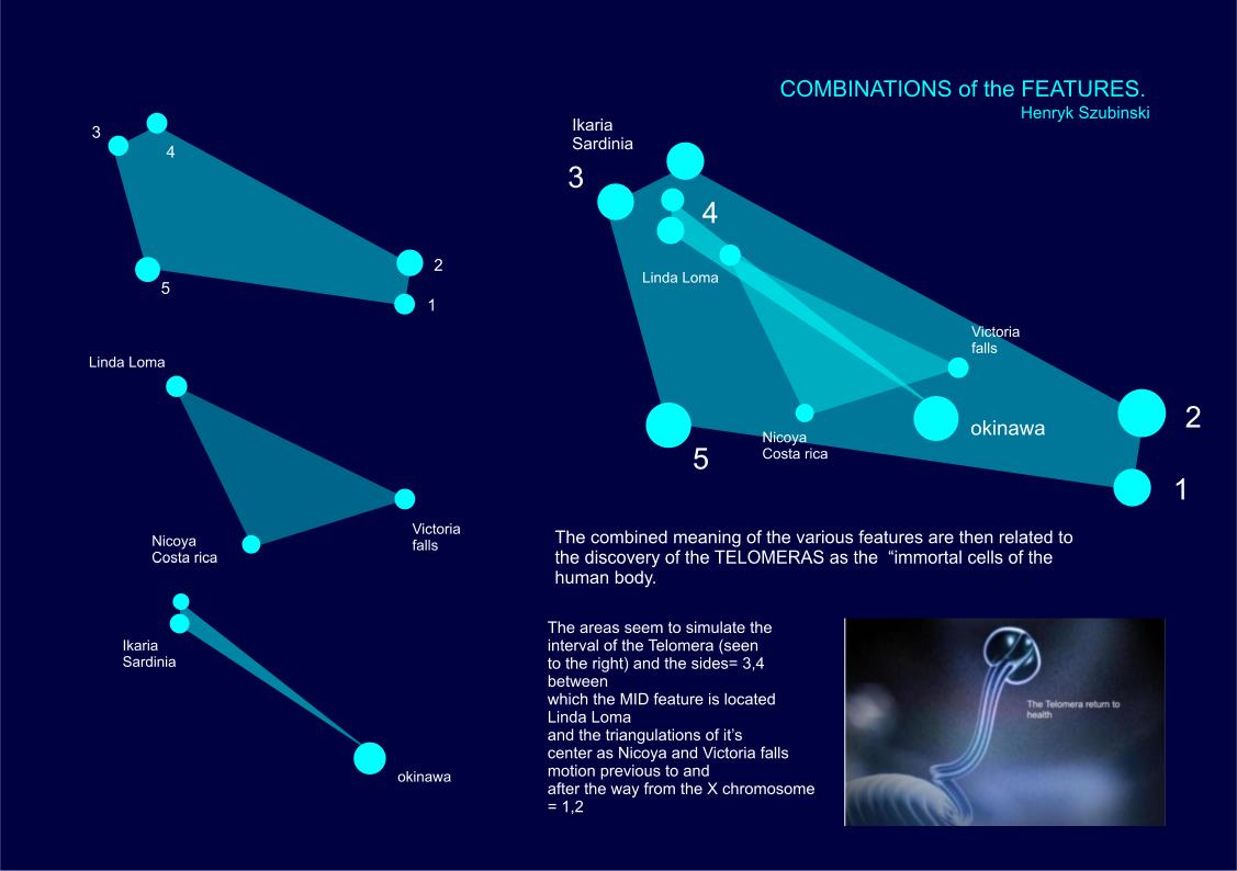
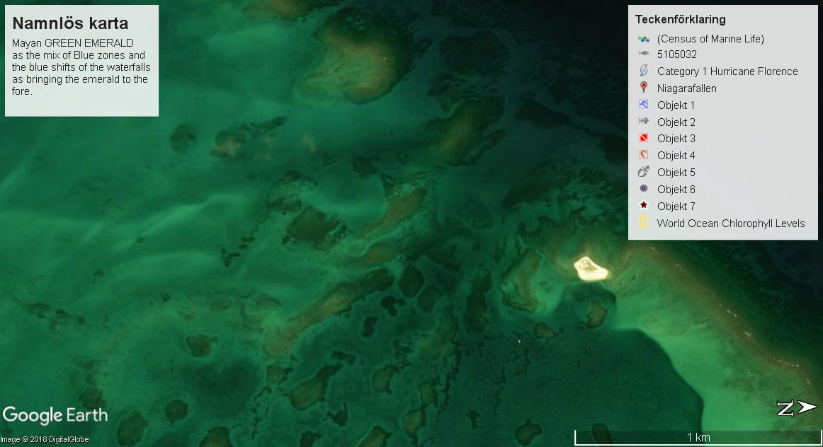
I searched in the center of the triangle between NICOYA and the Victoria falls and the Linda Loma to find clues to the creation of blue zones.
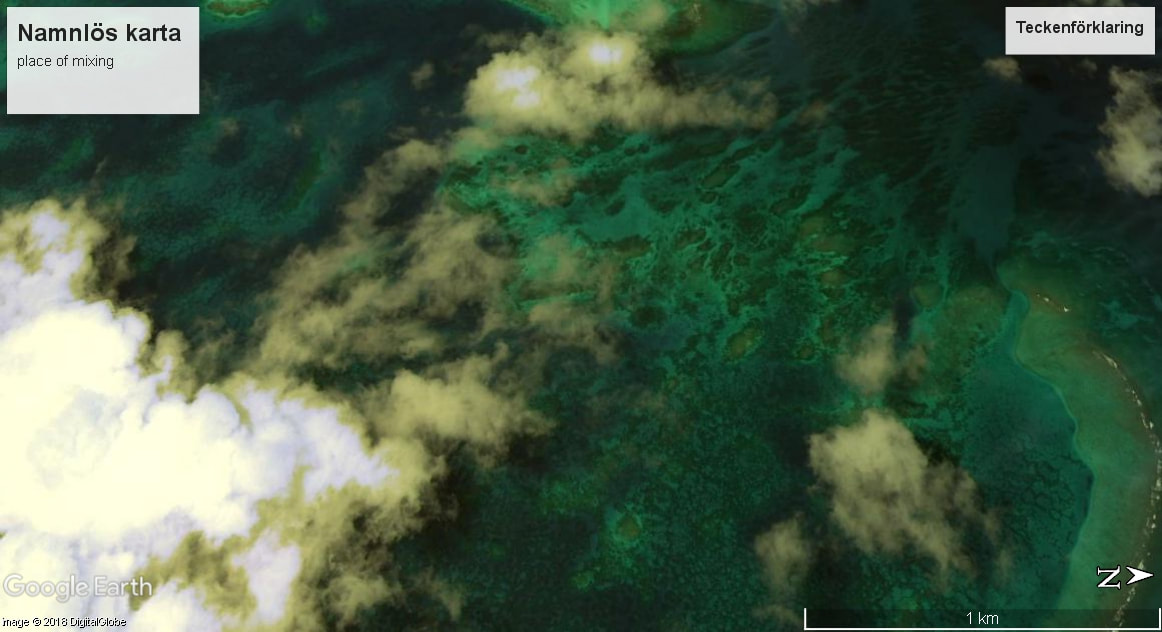
Here is what i found.
Here is what i found.
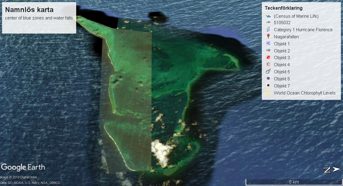
The color is of EMERALD as the MAYAN ancient civilization may indicate that the blue was mixed with Green by the blue shift of the waterfalls around the Earth.
from Wikipedia
date 2018
September 23
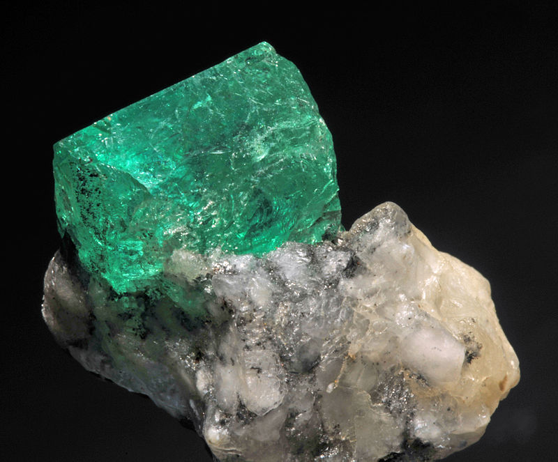
Emerald is a precious gemstone and a variety of the mineral beryl (Be3Al2(SiO3)6) colored green by trace amounts of chromium and sometimes vanadium.[2]Beryl has a hardness of 7.5–8 on the Mohs scale.[2] Most emeralds are highly included,[3] so their toughness (resistance to breakage) is classified as generally poor. Emerald is a cyclosilicate.
from Wikipedia
date 2018
September 23
Emerald is a precious gemstone and a variety of the mineral beryl (Be3Al2(SiO3)6) colored green by trace amounts of chromium and sometimes vanadium.[2]Beryl has a hardness of 7.5–8 on the Mohs scale.[2] Most emeralds are highly included,[3] so their toughness (resistance to breakage) is classified as generally poor. Emerald is a cyclosilicate.
The color of the EMERALDS must by some measure of the same color as the water = either the SKY BLUE REFRACTION on the water or that there are traces of EMERALD in the water that does the REFRACTION.This could result in the BLUE ZONE color.
They are sometimes heat treated, which causes their color to turn blue and transform into Aquamarine.
Some of the blue zones are in warm climates of water temperature so they could indicate that the
Aquamarine is the blue zone color as the result of the EMERALD HEATING.
They are sometimes heat treated, which causes their color to turn blue and transform into Aquamarine.
Some of the blue zones are in warm climates of water temperature so they could indicate that the
Aquamarine is the blue zone color as the result of the EMERALD HEATING.
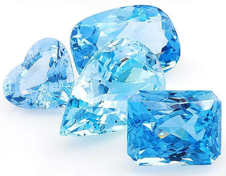
There are also other names fro the emerald color as being JADE.
from
Wikipedia
date 2018
September 23
The use of jade in Mesoamerica for symbolic and ideological ritual was highly influenced by its rarity and value among pre-Columbian Mesoamerican cultures, such as the Olmec, the Maya, and the various groups in the Valley of Mexico. Although jade artifacts have been created and prized by many Mesoamerican peoples, the Motagua River valley in Guatemala was previously thought to be the sole source of jadeite in the region.
This extreme durability makes fine grained or fibrous jadeite and nephrite highly useful for Mesoamerican technology. It was often worked or carved as ornamental stones, a medium upon which glyphs[1] were inscribed, or shaped into figurines, weapons, and other objects. Many jade artifacts crafted by later Mesoamerican civilizations appear cut from simple jade axes, implying that the earliest jadeite trade was based in utilitarian function.
The MAYAN city of GOLD , ELDORADO.
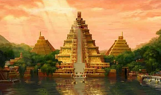
Possible position of ELDORADO as the EMERALD COLOR CLUE.
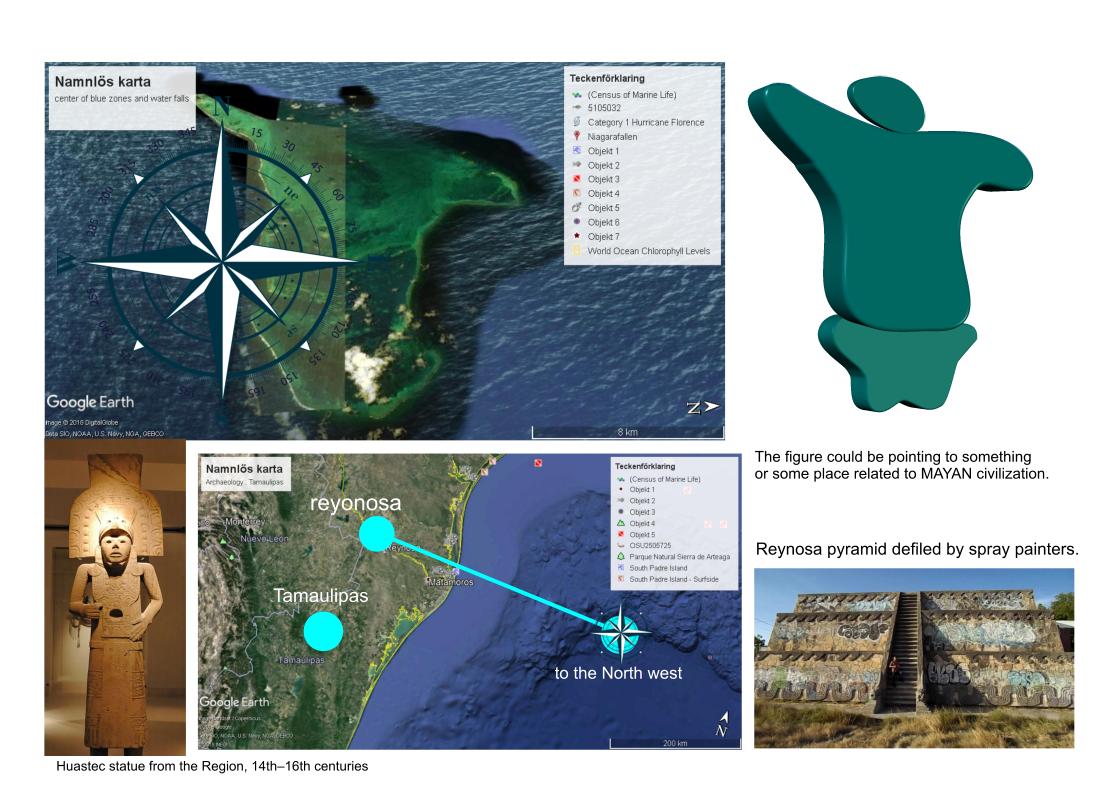
I honestly do not know what the SPRAY PAINTERS get from the defilement of ancient artifacts.
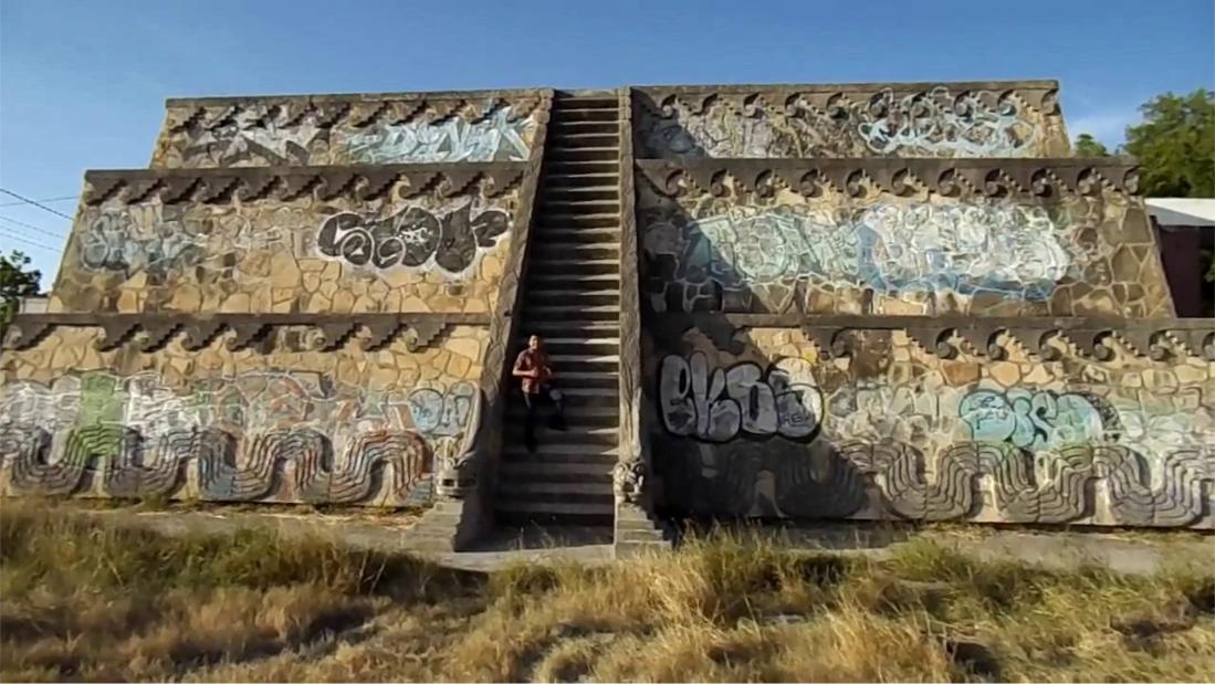
The island in EMERALD COLOR points to the END of MAYAN CIVILIZATION as the clue and the location of the PYRAMID that has been defiled by SPRAY PAINTERS.
Meaning that this is the sign of DEFILEMENT that no longer is avoided in many such examples of defilement of NATIONAL TREASURES.
what is defilement?.It's not defined archaeologically but it has some descriptions as "TO MAKE DIRTY" or impure by destroying the art of civilization.Also as contamination and pollution.Could be that the ancient source of civilization points to the facts of the need for HERITAGE PROTECTION.
The Department's Cultural Heritage Center specializes in the protection and preservation of ancient and historic monuments, objects, and archaeological sitesof the world, that enrich and inform today's societies, and help connect us to our cultural origins.
UNESCO world HERITAGE program does this together with others such as the US world heritage sites.
continuing with the theory of the EMERALD and AQUAMARINE link to BLUE ZONES.
The MAYAN calendar may indicate that the EMERALD WATER was at first poisonous to drink and that the center image of the figure shows this DISTASTE of the figure in the center, extending his tongue , as the indication that the CAUSE of the BLUE ZONES water effect may ,in it's AQUAMARINE also be poisonous. So the calendar would indicate the date when the EMERALD and AQUAMARINE are SO MIXED TOGETHER that it's TRUE BLUE ZONE SOURCE, meaning that the BLUE ZONE EFFECT started to appear in media about the time of 2012 as the MAYAN SAID IT WOULD. The ORIGIN may be places like this island of EMERALD or JADE.
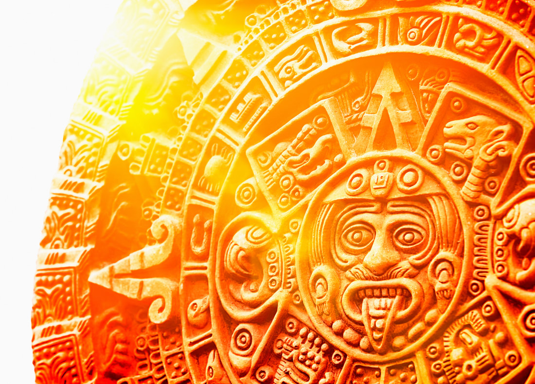
ELDORADO, the MAYAN city of GOLD ,could be the place of the YELLOW PYRAMID as the example of MAYAN COATING with stone that has yellow color, just like the EGYPTIAN PYRAMIDS used stones to cover their pyramids with white color.
Also, the facts that this MAYAN Yellow type of pyramid was built on an island or on a place where the water level had risen so as to isolate the pyramid. It could also be the BEACON for the SEA FARING MAYANS to use as their COMPASS so they would always find their way back to their LAND.
Also, the facts that this MAYAN Yellow type of pyramid was built on an island or on a place where the water level had risen so as to isolate the pyramid. It could also be the BEACON for the SEA FARING MAYANS to use as their COMPASS so they would always find their way back to their LAND.
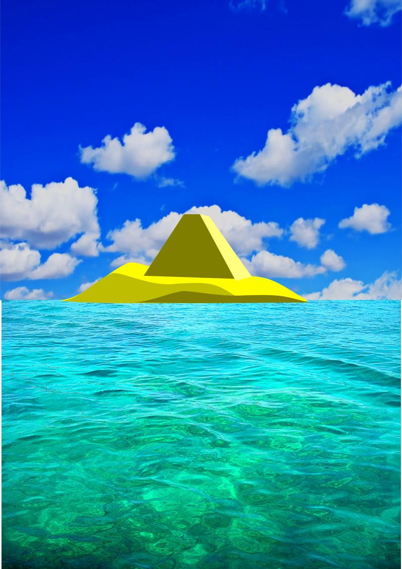
Pyramids would function as the BEACON in the night so that the fire was always kept burning through the nights for the sea farers to observe it together with traders on the surface of Earth as the GUIDE to the PORTALS of the trading ships and would indicate that there was a way that was faster than the NAVIGATION by the STARS. This method used the BRIGHTER SIDE of the PYRAMIDS 4 sides as the INDICATOR for where the CENTER of the WORLD was positioned so as to also be bright when the MOON was shining on it.
