

PROJECT POSSIBILITIES
by Henryk Szubinski
ONE OF THE NAMES ON THE MARS INSIGHT MISSION.
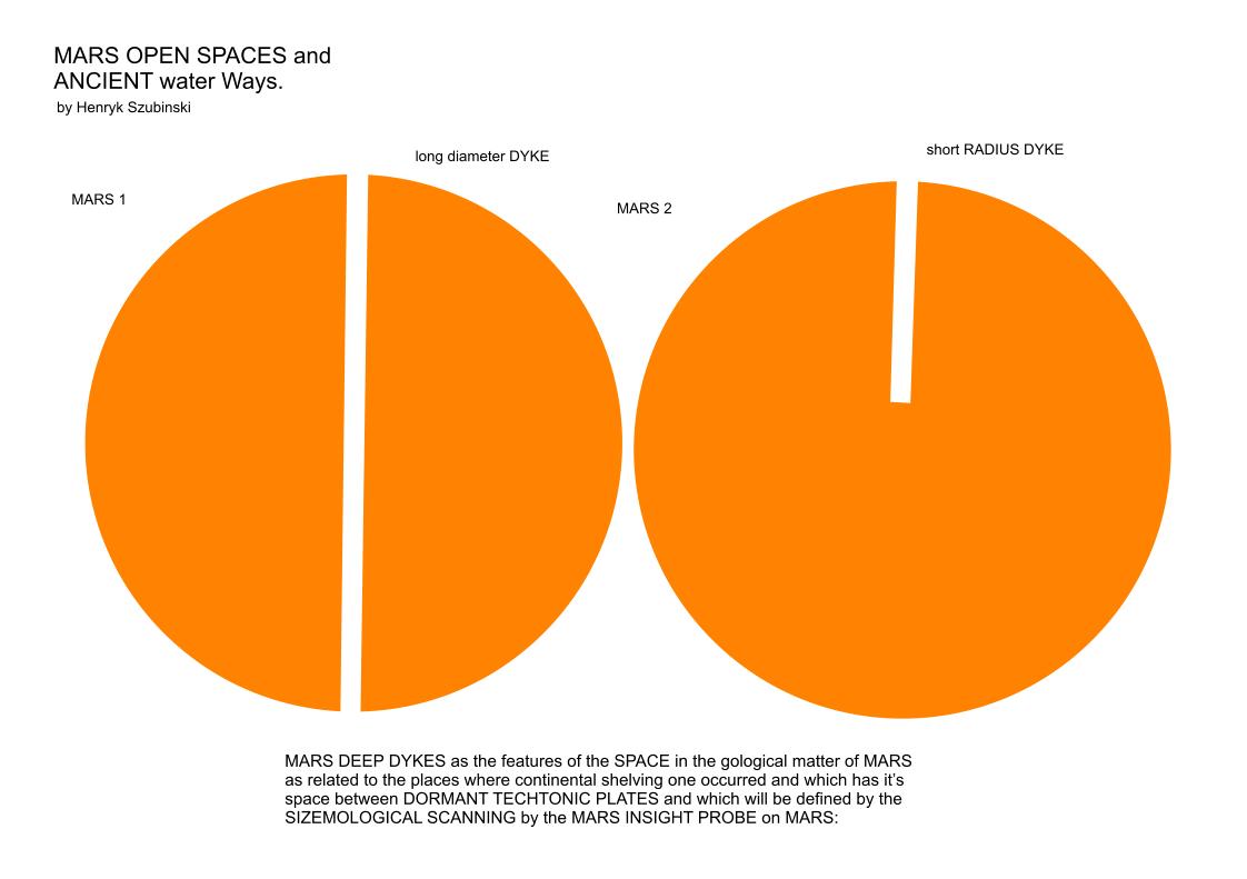
The ways into MARS are easily seen when relating to the fact that water displaces the fastest way downwards by reference to the places where there are openings to other layers of space and where HARD GEOLOGICAL matter is OPPOSED by yet harder matter that has to break apart and let the water through. In this way EROSION may be found by following the probability of WATER MOTION over the surface of MARS but also into it by way of SUBDUCTION, DYKES and SEISMOLOGY.
These have their MEDIUM WAVELENGTH as common to the MARS inner matter and their highest distribution could be the GUIDE to finding where there are GEOLOGICAL OPENINGS into MARS.
more:
Possibility that the inner MARS and the openings into it are covered by ROCKS that have been in LANDSLIDES and BLOCKED the PASSAGES into INNER MARS.
If that is the case, then Mars must have some variables of WET ROCKS or DRY ROCKS that creates STICKY or DUST types of rock.
image credit
Pintrest
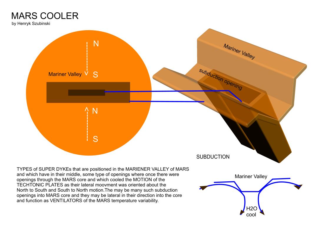
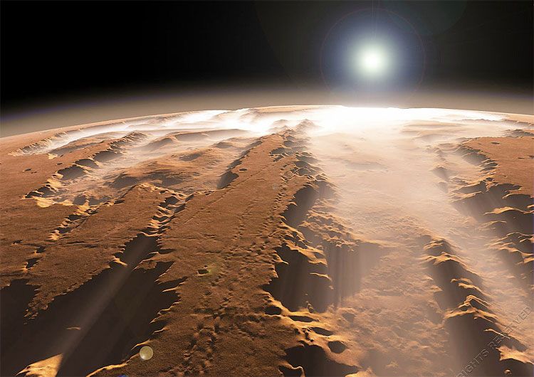
Mariner Valley.
Possibility that the inner MARS and the openings into it are covered by ROCKS that have been in LANDSLIDES and BLOCKED the PASSAGES into INNER MARS.
If that is the case, then Mars must have some variables of WET ROCKS or DRY ROCKS that creates STICKY or DUST types of rock.
image credit
Pintrest
Mariner Valley.
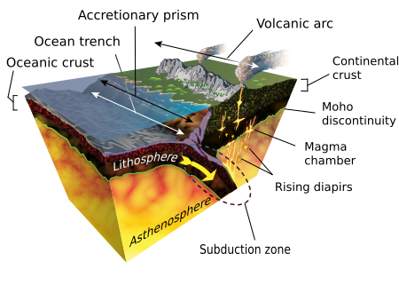
DYKES could reflect the signals from INSIGHT by using angles to the horizontal surface plane of MARS because they will be at angles to the horizon and in this way they may reflect back at 90 degrees of motion to places where there is SUBDUCTION.
more:
Mars could be full of SUBDUCTIONS, DYKES and SEISMOLOGICAL places. It could be so common that it could in fact, even be the case in total over the whole surface. Meaning that rocks and dust could be covering most of Mars surface while beneath these rocks , lay openings in wait.
If you gave Mars a shake it would probably displace most of the surface matter inwards. So in case we need to know the HOW ,of landing on Mars the answer might be, "Not on any Subductions or Dykes and not until the MARS INSIGHT has verified the possibilities by making measurements of the MARS surface stability. Mars missions could need to know where the surface is hard enough to LAND ON.
from:
www.geolsoc.org.uk/ks3/gsl/education/resources/rockcycle/page3672.html
date 2018
November 14
When molten magma flows upward through near-vertical cracks (faults or joints) toward the surface and cools, dykes are formed. Dykes are sheet-like igneous intrusions that cut across any layers in the rock they intrude.
In this example from the Channel Islands, two dykes can be seen above the cave roof, with a third further to the right.
These dykes are intruded into metamorphic gneiss. Dating of the radioactive minerals in the gneiss show that it is the oldest rock in southern Britain, at around 2500 million years old. The dykes are much younger.
A dike or dyke, in geological usage, is a sheet of rock that is formed in a fracture in a pre-existing rock body. Dikes can be either magmatic or sedimentary in origin. Magmatic dikes form when magma flows into a crack then solidifies as a sheet intrusion, either cutting across layers of rock or through a contiguous mass of rock. Clastic dikes are formed when sediment fills a pre-existing crack.[1]
SUBDUCTION
from
Wikipedia
date 2018
November 14
Subduction is a geological process that takes place at convergent boundaries of tectonic plates where one plate moves under another and is forced or sinks due to gravity into the mantle. Regions where this process occurs are known as subduction zones. Rates of subduction are typically in centimeters per year, with the average rate of convergence being approximately two to eight centimeters per year along most plate boundaries.[1]
Plates include both oceanic crust and continental crust. Stable subduction zones involve the oceanic lithosphere of one plate sliding beneath the continental or oceanic lithosphere of another plate due to the higher density of the oceanic lithosphere. That is, the subducted lithosphere is always oceanic while the overriding lithosphere may or may not be oceanic. Subduction zones are sites that usually have a high rate of volcanism and earthquakes.[2][better source needed] Furthermore, subduction zones develop belts of deformation and metamorphism in the subducting crust, whose exhumation is part of orogeny and also leads to mountain building in addition to collisional thickening.
The INSIGHT mission will be able to probe the SUBDUCTION of MARS by REFLECTING the signals ,similar to Seismological waves from hard rock layers to their directions as exposing the HARDER inner matter of MARS.
from
Wikipedia
date 2018
November 14
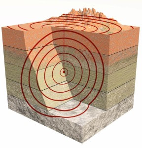
Seismology ( /saɪzˈmɒlədʒi/; from Ancient Greek σεισμός (seismós) meaning "earthquake" and -λογία (-logía) meaning "study of") is the scientific study of earthquakes and the propagation of elastic waves through the Earth or through other planet-like bodies. The field also includes studies of earthquake environmental effects such as tsunamis as well as diverse seismic sources such as volcanic, tectonic, oceanic, atmospheric, and artificial processes such as explosions. A related field that uses geology to infer information regarding past earthquakes is paleoseismology. A recording of earth motion as a function of time is called a seismogram. A seismologist is a scientist who does research in seismology.
The iNSIGHT mission will most definitely use the SEISMOLOGICAL instruments.
Wikipedia
date 2018
November 14
Seismology ( /saɪzˈmɒlədʒi/; from Ancient Greek σεισμός (seismós) meaning "earthquake" and -λογία (-logía) meaning "study of") is the scientific study of earthquakes and the propagation of elastic waves through the Earth or through other planet-like bodies. The field also includes studies of earthquake environmental effects such as tsunamis as well as diverse seismic sources such as volcanic, tectonic, oceanic, atmospheric, and artificial processes such as explosions. A related field that uses geology to infer information regarding past earthquakes is paleoseismology. A recording of earth motion as a function of time is called a seismogram. A seismologist is a scientist who does research in seismology.
The iNSIGHT mission will most definitely use the SEISMOLOGICAL instruments.
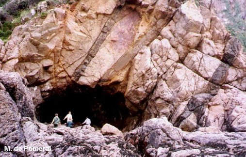
So MARS might be the PLANET of CAVES. And caves are :
as from Wikipedia:
A cave is a hollow place in the ground,[1][2] specifically a natural space large enough for a human to enter. Caves form naturally by the weathering of rock and often extend deep underground. The word cave can also refer to much smaller openings such as sea caves, rock shelters, and grottos, though strictly speaking a cave is exogene, meaning it is deeper than its opening is wide,[3] and a rock shelter is endogene.[4] A cavern is a specific type of cave, naturally formed in soluble rock with the ability to grow speleothems.[5]
Speleology is the science of exploration and study of all aspects of caves and the cave environment. Visiting or exploring caves for recreation may be called caving, potholing, or spelunking.
image of worlds biggest cave
image credit
RT com.
Son Doong Cave located in the jungles of inland Vietnam.
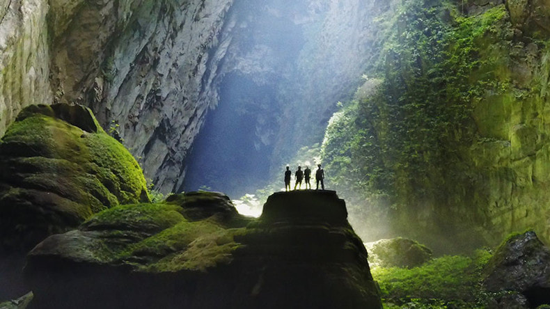
This type of CAVE could be the dominant feature of the LOWER SURFACE of the Mariner valley. They could in fact be 10 times larger than the one on the above image.
Inside them would be teeming with life, jungles,crystal colored blue lakes and organisms.
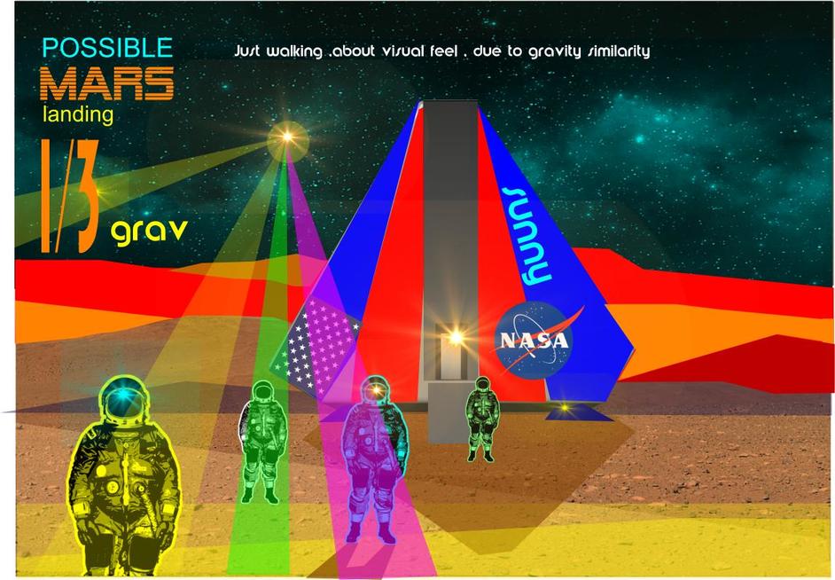
HARD COPY of my own design for the MARS MANNED LANDER.
Image credit:
Inside them would be teeming with life, jungles,crystal colored blue lakes and organisms.
HARD COPY of my own design for the MARS MANNED LANDER.
Image credit:
YOU NEVER KNOW WHAT SHADOWS YOU'RE CASTING ON MARS.
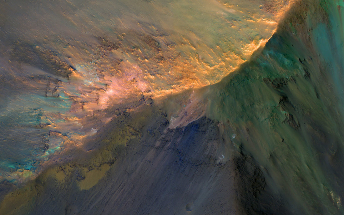
Most of Mars has variables of spectral shading.
AS IF and THEN THE.........OR WHAT is HIPPY AGAIN .
image credit
JPL NASA.
The Hills are Colorful in
OTHERWISE KNOWN AS :
Juventae Chasma
Most of Mars has variables of spectral shading.
AS IF and THEN THE.........OR WHAT is HIPPY AGAIN .
image credit
JPL NASA.
The Hills are Colorful in
OTHERWISE KNOWN AS :
Juventae Chasma
HUMANS MIGHT be even more spectral in CHANGE than the landscape on MARS due to NEW MATTER REFLECTIONS DENSITY of the SPACE SUITS and the SPACESHIP LANDER, COLOR INFLUENCES.
