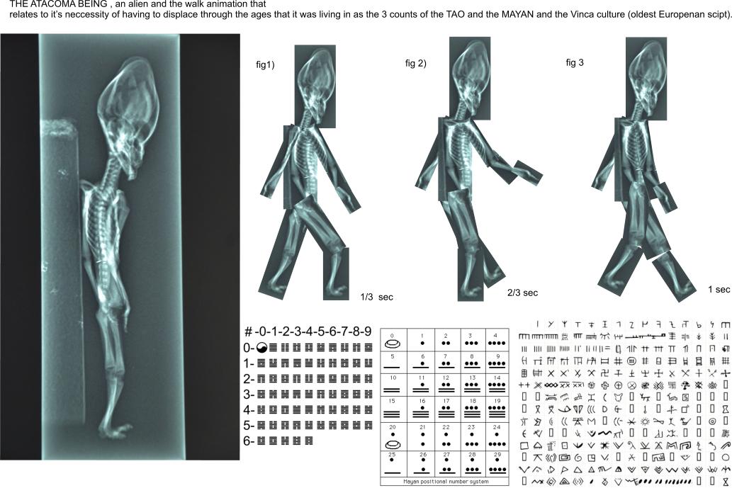
SIRIUS DISCLOSURE of some "PRIMAL THOUGHTS" to the Atacama being ,the meanings and relations of Earth
Geomantics ,the Mars one mission.
that which has the greatest surface pre, now and post references
of the human experiments on MARS for th populations living
there.
Images from upper and lower Mongolia and the SPACE TO FILL as the universe of Shrodinger that
may displace with the mind wave that recognises the totality of the biologically shared expansions
and contractions of the Earth through billions of years .
Erwin Shrodinger supposed that by argument of the total of every possible event being = 1
that "electrons think" and that everything may be alive, by reason to define the "quantum mechanics" from
the observatuion from space where by the effect of "pulling energy from the vacume" there must be
age old concepts derived from the point of observation from space that are the energy by which every
human once thought in relation to the Gods or the Aliens that there is no GAP in which the illogical
would "not be" what the translation of it means.
The influence of the land upon the human mind that lives upon it may in large be effected by the features of the
Earth though they are not directly visable, there are certain emotions that shamans knew and which told of the
GODS , that were above. The closer this link to humans the further humans displaced beyond the Earth. Perhaps,
when people colonize MArs and the other planets their geological features will no longer be that of the SHAMANS
dream but fyziological evidence of how planets effect mankind on them.
This would begin the new medicine of astronautical geographical influences on the human body as the language
that gets projected into the ways of living on other planets, that may help to avoid the pitfalls of early Earth civilization
and help to build something larger beyond the MAYAN dream of the galaxy being full of geological sublime messages.
Here then, the most PRIMAL THOUGHT of ancient CIVLIZATION, that of Geomancy.
date, 30,06,2016
time , 12:48
Geomancy (Greek: γεωμαντεία, "earth divination") is a method of divination that interprets markings on the ground or the patterns formed by tossed handfuls of soil, rocks, or sand. The most prevalent form of divinatory geomancy involves interpreting a series of 16 figures formed by a randomized process that involves recursion followed by analyzing them, often augmented with astrologicalinterpretations.
Once practiced by people from all social classes, it was one of the most popular forms of divination throughout Africa and Europe in the Middle Ages and the Renaissance. Books and treatises on geomancy were published up until the 17th century when most occult traditions fell[citation needed] out of popularity.
In Renaissance magic, geomancy was classified as one of the seven "forbidden arts", along with necromancy, hydromancy,aeromancy, pyromancy, chiromancy (palmistry), and spatulamancy (scapulimancy).[1]
Geomancy is also another word for earth magic and the associated powers of the earth, such as healing[citation needed].
Geomancy is dismissed by the scientific community and skeptics as being superstition.
continuing then,to define the alternate volumes of advanced human thought and language as the new medicine of GEOMANTIC OR
ANTI GEOMANTIC THOUGHT.
Here then, the word GEOMETICAL
Geometry (from the Ancient Greek: γεωμετρία; geo- "earth", -metron "measurement") is a branch of mathematics concerned with questions of shape, size, relative position of figures, and the properties of space. A mathematician who works in the field of geometry is called a geometer. Geometry arose independently in a number of early cultures as a body of practical knowledge concerning lengths,areas, and volumes, with elements of formal mathematical science emerging in the West as early as Thales (6th century BC). By the 3rd century BC, geometry was put into an axiomatic form by Euclid, whose treatment--Euclidean geometry—set a standard for many centuries to follow.[1] Archimedes developed ingenious techniques for calculating areas and volumes, in many ways anticipating modernintegral calculus. The field of astronomy, especially as it relates to mapping the positions of stars and planets on the celestial sphereand describing the relationship between movements of celestial bodies, served as an important source of geometric problems during the next one and a half millennia. In the classical world, both geometry and astronomy were considered to be part of the Quadrivium, a subset of the seven liberal arts considered essential for a free citizen to master.
also
Geomatics, also known as geospatial technology, geomatics engineering, or geomatic engineering is the discipline of gathering, storing, processing, and delivering geographic information, or spatially referenced information. In other words, it "consists of products, services and tools involved in the collection, integration and management of geographic data".[1]
Important data on the new theory of ASTRONAUTICAL ASSOCIATIONS.
and the opposite of Geometrical as random or organic.
The greater the random apperance of geological features, the greater the organic apperance of the organic features of every flora and fauna
as in higher and higher biological variability so that the organisms may aquire such random GEOMANTIC apperance that they may be more random
than the geology or that the Geology has greater randomeness than the flora. The fauna may also have greater randowmness than flora in which case
the geometry has greater variability.
So there are some basic references to Geology as G and Geomancy as O and the flora as F and the Fauna as A
these 4 variables are exponentially related to their exponential as 4 to the 4 =256 variables that define the whole universe .
The amount of aliens and humans on those planets are another 2 exponentials as
4 to the 6 =4096 variables.
The truth of this as the basic civilization and how it relates everything to the above mentiond data, that it = EMPIRE o EMPIRICAL SYSTEMS
of the EMPERORS that existed in every civilization by variables of their names. Each emirical system has to fit into the next in some basic
levels.
That the Earth geology had GEOMANTIC translations to EMPIRICAL indicates that the continuous references to LAND or MONEY to define
how the human mind could be free from the geological symbols on our psyche translating the Earth's features . This is known as GI o Righteousness (from Japaneese
early age= the direction of Earth's rotation ). The definition of how many GEOMANTIC RELATIONSHIPS are possible with the 4096 has it's limit
of GI at 10 000 KI= MAN ( as the Japaneese for 10 000
or human and Earth relations ) This nr appears in Mayan civilization and may translate many systems of counting in ancient civilizations.
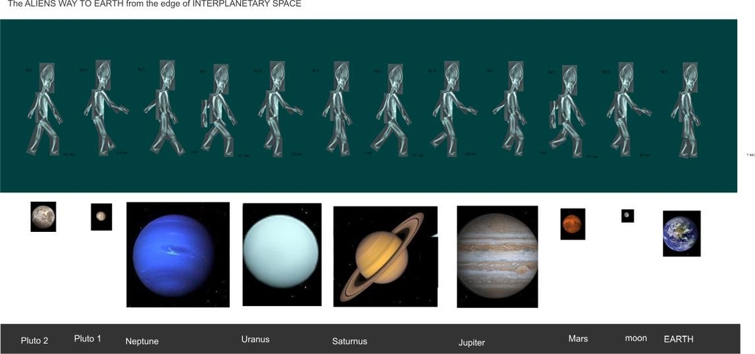
So this knowledge indicates how any habitation of other planets by humans on MArs or any planet in our INTERPLANETARY SPACE LIMIT
and where to START any space program.The basics of the NATURE and HUMAN at it's closest reference =the fauna as the best way to GO
for space as prior to the money or land, because flora may be harvested in space without money as an economical system START .
This free economy in zero gravity would then be able to define the economical and land system.
.
Every space has been filled .
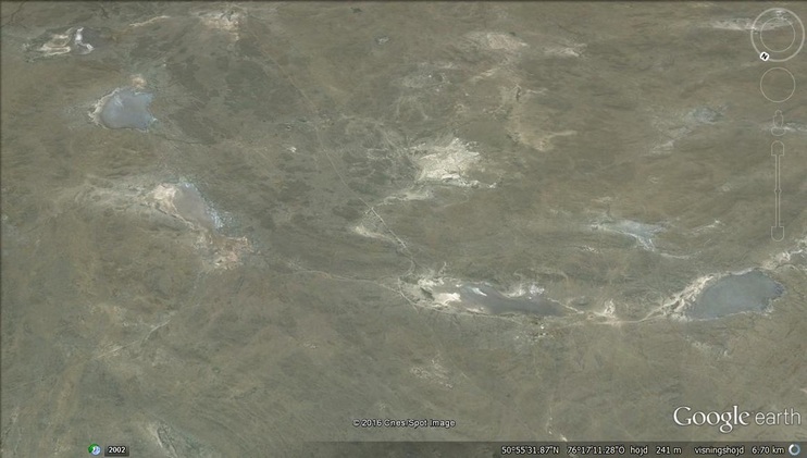
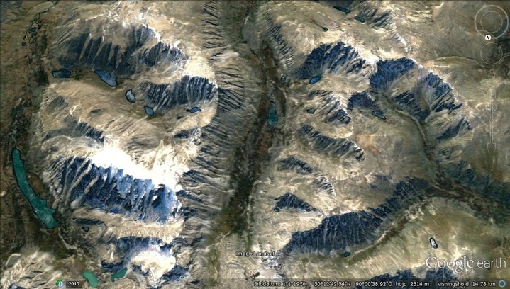
Here then, such variances of the landscape of the higher Mongolian and lower Mongolian .
"Probably the most varied landscape on the face of the Planet.
Here are some interesting observations".
Here are some Gemantic figures.Geomantic figures are the basic counting systems of the I CHING, the Mayan Calendar count , the Hyroglyphs used as the mythology
of the genealogy of the GODS but amy also contain ALIEN MENTIONS. In Ancient Europe these were not figures of knowledge , they were rocks that were placed in places like STONHENGE that were heavier and more real so that the exchange of nature indicates that they function. Getting equipment to MARS or other planets would also have to take into consideration that pre defined structures may be simulated so as to give REAL representations of the EMPIRICAL SYSTEM of that PLANET and the technology of the future where the TECHNOLOGY follows the reason of the STONHENGE structures.

The language of Earth as compared to Mars as having similarity to the most variable landscape on Earth as the MOngolian type. The comparison is made with Mars as having similar variables where the distance between the Earth and Mars may define the topography as STRETCHED OUTWARDS and then finding ways TO WALK IT as the reference to where the MARS TOPOGRAPHY and the EARTH TOPOGRAPHY are DISSIMILAR at some point comparison where the GAP nd the ways back and forth = the
GREATER and the LESSER.
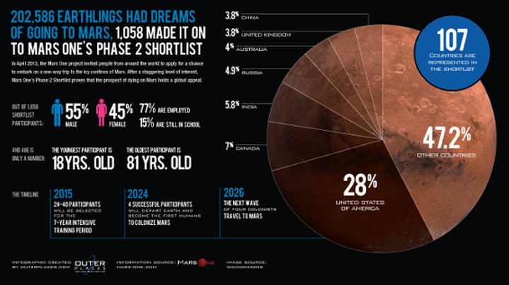
Image of the MARS ONE missions.
GREATER and the LESSER.
Image of the MARS ONE missions.
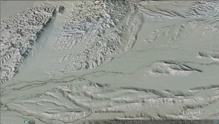
Here then , a leaf shape seen from space.
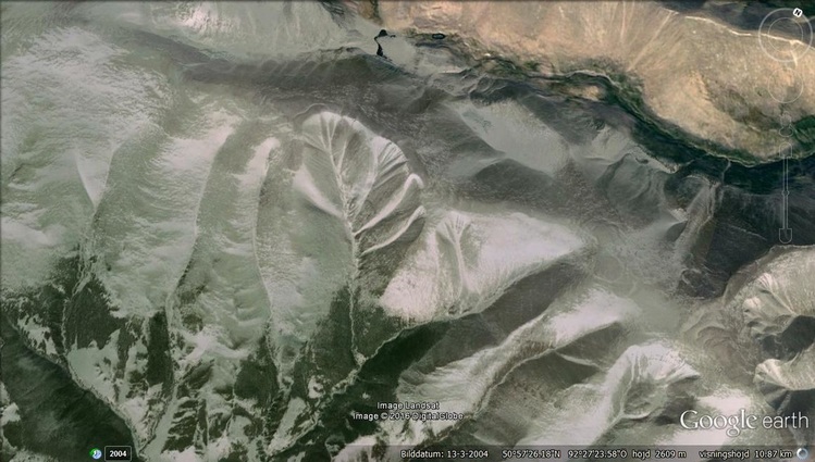
Blue and brown together in harmony. Focus on the lakes and their blueness appears.
You could imagine that these sedimentary layers are vertical but they are infact horizontal from up above and show sedimentation as flat, probably by another gravity event in the horizontal direction, might be the moon.

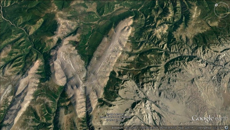
The only shape of a human brain i have seen on the planet Earth's surface.
Smaller triangle inside larger triangle inside larger triangle. Might appear like a head and the upper body of some figure.The only figure of peoples from this region of SIBERIA or MONGOLIA would be the Kurgan "STEPPES PEOPLE " or defined as "The SKY GODS" that worshipped the blue sky ( notice that the figure is looking upwards).These regions were probably so cold that the blue sky was warmer.
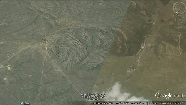
Appears as the surface of another planet.
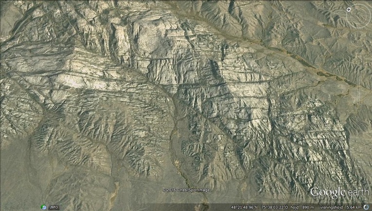
more stratification of the sediment layers but the angles are too horizontal for the layers to be an indication of the usual history of sediment ages .Another example of flatness with layers.
blue snow regions that appear like 2 feet directed upwards or as a face on the left and a hand on the right.
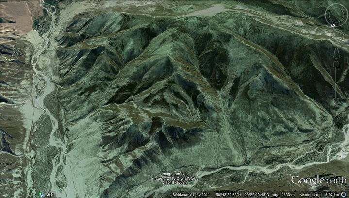
Interesting fold with a cleavage section where the vergance occurs.
time 13:31
date 30,06,2016
As related to the MOST PRIMAL THOUGHT of ancient MAN.
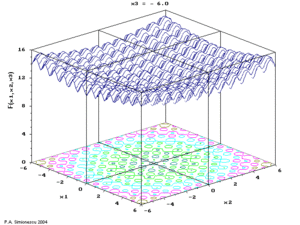
In geometry, a hypersurface is a generalization of the concept of hyperplane. Suppose an envelopingmanifold M has n dimensions; then any submanifold of M of n − 1 dimensions is a hypersurface. Equivalently, the codimension of a hypersurface is one. For example, the n-sphere in Rn + 1 is called ahypersphere. Hypersurfaces occur frequently in multivariable calculus as level sets.
In Rn, every closed hypersurface is orientable.[1] Every connected compact hypersurface is a level set,[2]and separates Rn in two connected components,[2] which is related to the Jordan–Brouwer separation theorem.
date 30,06,2016
As related to the MOST PRIMAL THOUGHT of ancient MAN.
In geometry, a hypersurface is a generalization of the concept of hyperplane. Suppose an envelopingmanifold M has n dimensions; then any submanifold of M of n − 1 dimensions is a hypersurface. Equivalently, the codimension of a hypersurface is one. For example, the n-sphere in Rn + 1 is called ahypersphere. Hypersurfaces occur frequently in multivariable calculus as level sets.
In Rn, every closed hypersurface is orientable.[1] Every connected compact hypersurface is a level set,[2]and separates Rn in two connected components,[2] which is related to the Jordan–Brouwer separation theorem.
Referenced interaction of the GO for Mars and the data from the past to the new definitions of making it happen.